Exploring the Himalayan Rivers of India: Indus, Ganga, and Brahmaputra
Exploring the Himalayan Rivers of India: Indus, Ganga, and Brahmaputra
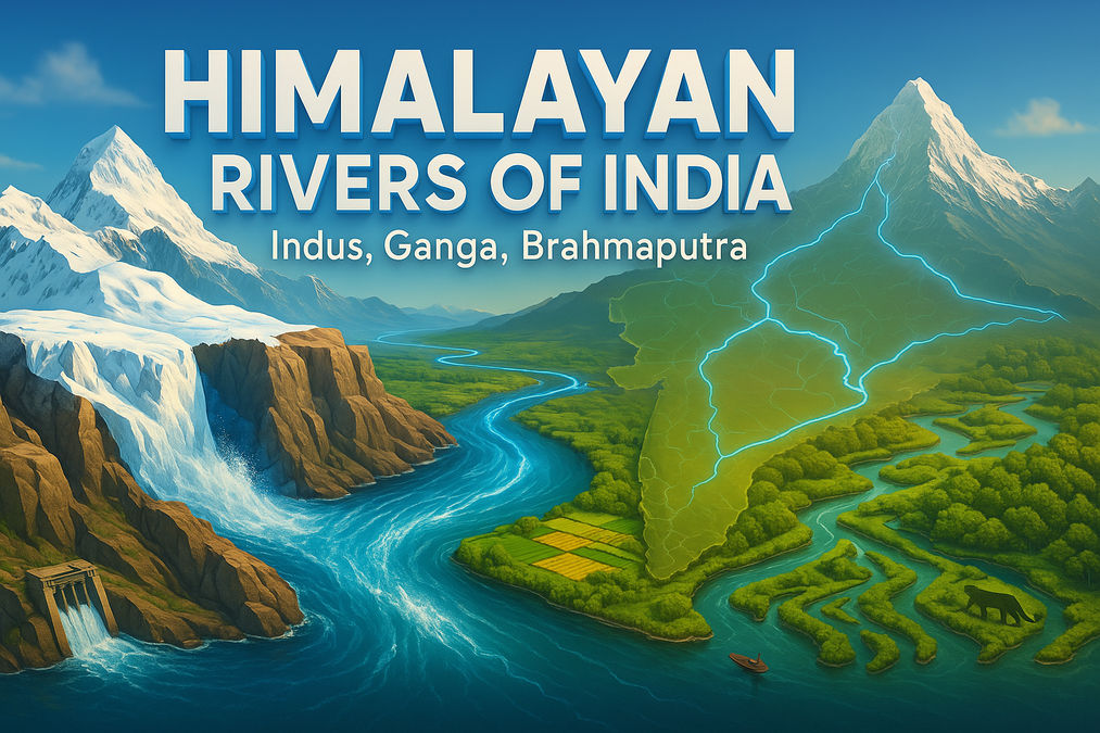
The Himalayan rivers are the lifelines of northern India, shaping its geography, economy, and culture. Originating from the majestic Himalayas, rivers like the Indus, Ganga, and Brahmaputra carry water, silt, and life across vast plains, supporting millions of livelihoods. This article dives into their origins, characteristics, and significance.
Did You Know? The Ganga has the largest river basin in India, sustaining agriculture and livelihoods for millions.
Overview of Himalayan Rivers
The Himalayan rivers, including the Indus, Ganga, and Brahmaputra, are perennial, fed by rain and snowmelt from the Himalayas. They carve gorges in their upper courses, form meanders and deltas in their lower courses, and play a vital role in India's economy.
The Indus River System
The Indus originates near Lake Mansarowar in Tibet, flows through Ladakh, and forms a picturesque gorge. Joined by tributaries like the Zaskar, Nubra, and Satluj, it stretches 2,900 km, making it one of the world's longest rivers. Its gentle slope creates a vast plain, with a third of its basin in India.
Indus Water Treaty: India can use only 20% of the Indus water for irrigation in Punjab, Haryana, and Rajasthan, per the 1960 treaty with Pakistan.
The Ganga River System
The Ganga, starting as the Bhagirathi from the Gangotri Glacier, meets the Alaknanda at Devaprayag. It emerges onto the plains at Haridwar, joined by tributaries like the Yamuna and Ghaghara. Spanning over 2,500 km, it forms the Sundarban Delta, the world's largest and fastest-growing delta.
The Brahmaputra River System
The Brahmaputra, known as Tsang Po in Tibet, originates east of Mansarowar Lake. It enters India as the Dihang, forming a braided channel in Assam with riverine islands like Majuli, the world's largest. Its high silt load causes frequent flooding in Assam and Bangladesh.
Timeline: Journey of the Himalayan Rivers
Origin
Indus and Brahmaputra rise in Tibet near Mansarowar Lake; Ganga starts at Gangotri Glacier.
Upper Course
Carve deep gorges through the Himalayas, carrying heavy silt loads.
Middle Course
Form meanders and oxbow lakes in the plains, supporting fertile floodplains.
Lower Course
Create vast deltas, like the Sundarban Delta, before draining into the sea.
Comparison of Himalayan Rivers
| River | Length (km) | Origin | Major Tributaries |
|---|---|---|---|
| Indus | 2,900 | Lake Mansarowar, Tibet | Satluj, Beas, Ravi, Chenab, Jhelum |
| Ganga | 2,500 | Gangotri Glacier, Uttarakhand | Yamuna, Ghaghara, Gandak, Kosi |
| Brahmaputra | 2,900+ | Tibet, east of Mansarowar | Dihang, Dibang, Lohit |
Economic Importance
Himalayan rivers are crucial for irrigation, hydropower, navigation, and agriculture. They support major cities and fertile plains, driving India's economic growth. However, pollution and overuse threaten their sustainability.
Conservation Efforts: The Namami Gange Programme aims to reduce pollution and rejuvenate the Ganga River.
FAQs
What are the major Himalayan rivers in India?
The major Himalayan rivers in India are the Indus, Ganga, and Brahmaputra.
Where does the Indus River originate?
The Indus River originates in Tibet near Lake Mansarowar.
What is the largest river basin in India?
The Ganga River has the largest river basin in India.
Why is the Ganga River important?
The Ganga supports agriculture, provides water for irrigation, and is culturally significant.
What is the Brahmaputra called in Tibet?
In Tibet, the Brahmaputra is known as the Tsang Po.
What are the tributaries of the Ganga?
Major tributaries of the Ganga include the Yamuna, Ghaghara, Gandak, and Kosi.
What is the Sundarban Delta?
The Sundarban Delta is the world's largest and fastest-growing delta, formed by the Ganga and Brahmaputra rivers.
Why does the Brahmaputra cause floods?
The Brahmaputra carries large volumes of water and silt during the rainy season, leading to frequent flooding in Assam and Bangladesh.
What is the Indus Water Treaty?
The Indus Water Treaty (1960) allows India to use 20% of the Indus river system's water for irrigation in Punjab, Haryana, and Rajasthan.
Where do the headstreams of the Ganga meet?
The Bhagirathi and Alaknanda, the headstreams of the Ganga, meet at Devaprayag in Uttarakhand.
Conclusion
The Himalayan rivers are the backbone of India's geography and economy. Their perennial flow, vast basins, and fertile deltas sustain millions, but challenges like flooding and pollution require urgent action. Explore these rivers further to appreciate their role in shaping India.
Learn More About India's Geography
Join the conversation