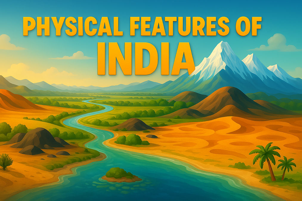
Physical Features of India: A Diverse Geographical Marvel
Discover the diverse physical features of India, from the Himalayan Mountains to the Peninsular Plateau, Coastal Plains, and Islands...
Physical Features of India: A Diverse Geographical Marvel
Physical Features of India: A Diverse Geographical Marvel
India, a land of incredible diversity, boasts a remarkable array of physical features of India, from towering mountains to sprawling plains and sandy deserts. This blog post dives into the six major physiographic divisions that shape India's unique geography, offering insights into their formation, characteristics, and significance.
Did You Know? India’s geography includes almost every major physical feature of the Earth—mountains, plains, deserts, plateaus, and islands!
Overview of India’s Physical Features
The physical features of India are categorized into six physiographic divisions, each with distinct geological and geographical characteristics. These include:
The Himalayan Mountains
The Northern Plains
The Peninsular Plateau
The Indian Desert
The Coastal Plains
The Islands
Timeline of India’s Geological Formation
Ancient Times
The Peninsular Plateau, one of the oldest landmasses, forms as part of the Gondwana land.
Millions of Years Ago
The Himalayas begin forming due to tectonic collisions, creating a youthful and unstable mountain system.
Recent Geological Period
The Northern Plains form through alluvial deposits by rivers like the Indus, Ganga, and Brahmaputra.
Major Physiographic Divisions
The Himalayan Mountains
The Himalayas, stretching 2,400 km from the Indus to the Brahmaputra, are young fold mountains with peaks like Kanchenjunga and Nanga Parbat. They consist of three ranges: Himadri, Himachal, and Shiwaliks.
The Northern Plains
Formed by the Indus, Ganga, and Brahmaputra rivers, the Northern Plains span 7 lakh sq. km and are known for fertile soil and dense population.
Fun Fact: Majuli, in the Brahmaputra River, is the world’s largest inhabited riverine island!
The Peninsular Plateau
This ancient tableland, made of crystalline, igneous, and metamorphic rocks, includes the Central Highlands and Deccan Plateau. Peaks like Anai Mudi (2,695 m) mark its diversity.
The Indian Desert
Located near the Aravali Hills, the Indian Desert features sand dunes and low rainfall, with the Luni River as its primary water source.
The Coastal Plains
India’s coastal plains include the Konkan, Kannad, and Malabar coasts on the west and the Northern Circar and Coromandel coasts on the east, with features like Lake Chilika.
The Islands
India’s two island groups—Lakshadweep and Andaman and Nicobar—are known for coral reefs and biodiversity, with Kavaratti as Lakshadweep’s administrative hub.
Comparison of Physiographic Divisions
Division
Key Features
Location
Himalayan Mountains
Young fold mountains, high peaks, glaciers
Northern India
Northern Plains
Fertile alluvial soil, densely populated
Below Himalayas
Peninsular Plateau
Old crystalline rocks, Deccan Trap
Central and Southern India
Indian Desert
Sand dunes, low rainfall
Western India
Coastal Plains
Narrow western coast, wide eastern deltas
Along Arabian Sea and Bay of Bengal
Islands
Coral reefs, biodiversity
Arabian Sea and Bay of Bengal
FAQs About Physical Features of India
What are the major physical features of India?
The major physical features of India include the Himalayan Mountains, Northern Plains, Peninsular Plateau, Indian Desert, Coastal Plains, and Islands.
What is the Peninsular Plateau made of?
The Peninsular Plateau is composed of old crystalline, igneous, and metamorphic rocks, formed due to the breaking and drifting of Gondwana land.
Which is the largest riverine island in the world?
Majuli, located in the Brahmaputra River, is the largest inhabited riverine island in the world.
What is the Indian Desert known for?
The Indian Desert, located near the Aravali Hills, is known for its undulating sandy plains, sand dunes, and low rainfall below 150 mm per year.
What are the two island groups of India?
India has two island groups: the Lakshadweep Islands in the Arabian Sea and the Andaman and Nicobar Islands in the Bay of Bengal.
What is the bhabar region?
The bhabar is a narrow belt of 8 to 16 km in width, parallel to the Shiwaliks, where rivers deposit pebbles after descending from the mountains.
What is the difference between bhangar and khadar?
Bhangar is older alluvium above floodplains with calcareous deposits called kankar, while khadar is newer, fertile floodplain soil renewed annually.
What are the Western Ghats known for?
The Western Ghats cause orographic rain, are higher than the Eastern Ghats, and include peaks like Anai Mudi and hill stations like Ooty.
What is the significance of the Northern Plains?
The Northern Plains, formed by the Indus, Ganga, and Brahmaputra rivers, are fertile, densely populated, and agriculturally productive.
What are the types of coral reefs found in Lakshadweep?
The Lakshadweep Islands feature barrier reefs, fringing reefs, and atolls, formed by coral polyps secreting calcium carbonate.
What is the Deccan Trap?
The Deccan Trap is a black soil area of volcanic origin in the Peninsular Plateau, formed by igneous rocks that have denuded over time.
What is the terai region in the Northern Plains?
The terai is a wet, swampy, and marshy region south of the bhabar belt, where streams re-emerge, once thickly forested but now used for agriculture.
Which rivers form the Northern Plains?
The Northern Plains are formed by the Indus, Ganga, and Brahmaputra rivers along with their tributaries, depositing alluvial soil.
What are the Central Highlands?
The Central Highlands are part of the Peninsular Plateau north of the Narmada River, including the Malwa Plateau and drained by rivers like the Chambal.
What is the significance of Lake Chilika?
Lake Chilika, located on the eastern coast in Odisha, is India’s largest saltwater lake, known for its biodiversity and proximity to the Mahanadi delta.
What are doabs in the Northern Plains?
Doabs are land areas between two rivers in the Punjab Plains, formed by the Indus and its tributaries like the Jhelum and Ravi.
What are the major hill ranges in the Deccan Plateau?
The Deccan Plateau includes hill ranges like the Satpura, Mahadev, Kaimur, and Maikal ranges, with the Garo, Khasi, and Jaintia hills in the northeast.
What is the role of the Aravali Hills in the Indian Desert?
The Aravali Hills mark the eastern boundary of the Indian Desert, separating it from the Peninsular Plateau and influencing its arid climate.
Conclusion
The physical features of India showcase a stunning blend of geological history and natural beauty. From the rugged Himalayas to the fertile Northern Plains and coral-laden islands, India’s geography is a testament to nature’s diversity. Explore these regions to appreciate the country’s unique landscape!
My name is Rajesh Kumar, and I am from Gharsana, Sri Ganganagar in Rajasthan. I have completed my Bachelor of Science (B.Sc.) in 2017 and Bachelor of Education (B.Ed.) in 2019 from Maharaja Ganga Singh University, Bikaner. I hold a Master’s degree (M.A.) in Philosophy, completed in 2022, and I am currently pursuing M.A. in Sociology.
I have work experience in the insurance sector and possess strong skills in MS Office, typing, and I hold a certificate in RSCIT. I am fluent in Hindi, Punjabi, and English. At present, I am preparing for competitive exams like DSSSB and UGC NET (Philosophy).
I also run educational blog called “The Govt Guide” & "Literary Sphere", where I post content related to NCERT Notes, Govt job vacancy, literature and exam preparation. My hobbies include playing chess and reading books.
Join the conversation